In today’s rapidly evolving environment, we understand that the availability of accurate and up-to-date information is paramount in enabling our customers to make informed decisions, plan strategically, and invest wisely.
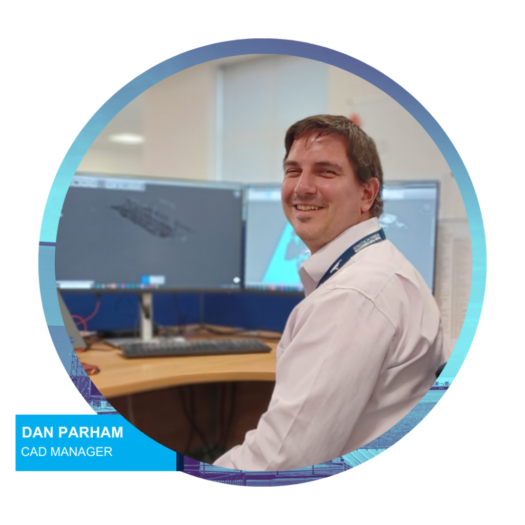
Meet the Expert: CAD Manager, Dan Parham
In this interview with Dan Parham, the CAD Team Manager at KBS Maritime, we will delve into the world of map making, the technology we use, and how we utilise that to meet the evolving needs of His Majesty’s Naval Base Portsmouth and the Royal Navy.
Q: Can you tell us about the role of your team in managing and maintaining the master drawing sets at Portsmouth Naval Base?
A: Our team is responsible for creating and maintaining the master drawing sets that serve as the foundation for all of our projects. These drawing sets encompass a wide range of information, including site plans, underground service drawings, location plans, schematics, 3D models, and more. By diligently organising and updating these drawings, we ensure that the KBS team and our Customer, the UK MOD, have the accurate and up-to-date information necessary to effectively plan and manage the infrastructure of the Naval Base.
Q: How does technology play a role in your team’s work?
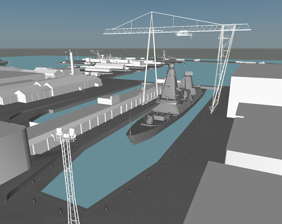
A: Technology is at the heart of what we do. We leverage various tools and software to enhance our capabilities and streamline our processes. We employ 3D modeling and are developing our Building Information Modelling (BIM) capabilities. These technologies will enable us to create virtual 3D representations of structures and infrastructure, allowing us the ability to visualise and plan projects with a high level of accuracy. There is the opportunity to identify potential clashes, optimise designs, and as we mature, we will be able to simulate real-world scenarios before construction even begins. We have also used drone-captured photogrammetry. By deploying drones equipped with a high-resolution camera, we have captured detailed aerial imagery of the whole Naval Base. We then process this data to create accurate geo-referenced maps.
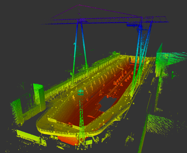
Q: You are also using “point cloud scans.” Can you explain what that entails and how it is used?
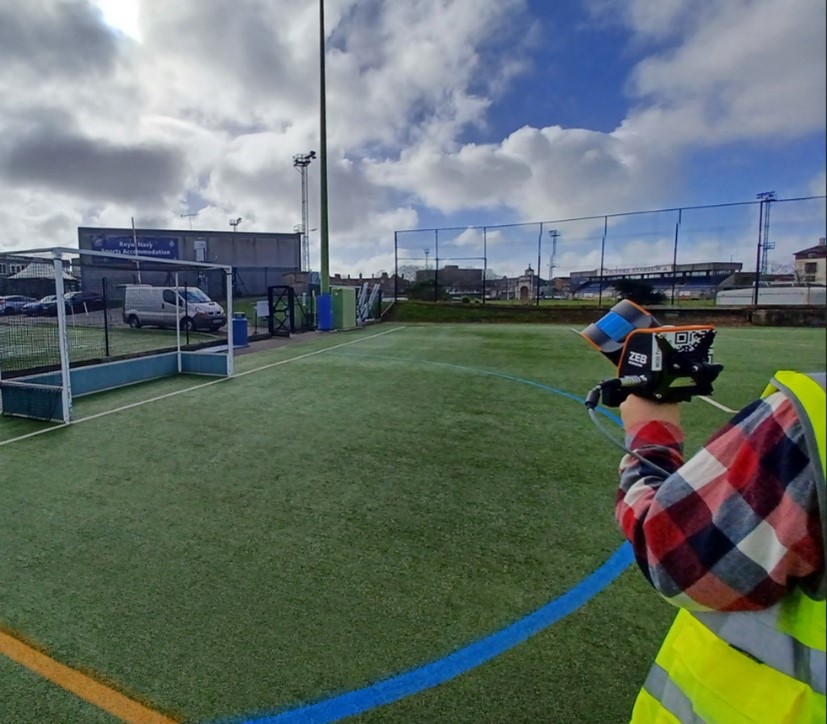
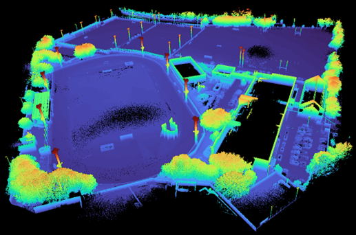
A: Point cloud scans are created using laser scanning technology called Light Detection and Ranging, also known as ‘Lidar’. These scanners emit laser pulses, 300,000 times a second, that bounce off objects and return to the scanner, generating millions of individual data points. These points collectively form a “point cloud” that represents the shape and position of the objects scanned. We can then import this point cloud data into specialised software, allowing us to create 3D models and 2D maps of existing structures and terrain. Point cloud scans are invaluable for accurate measurements, creating as-built documentation, and conducting precise analyses for renovation and expansion projects.
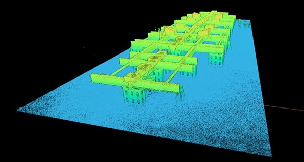
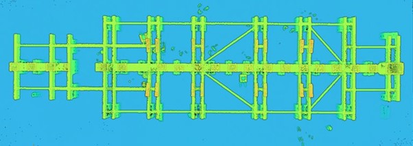
Q: Do you use point cloud scanning for other data capture and insight?
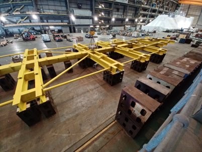
A: Yes, we also utlise point cloud scans for the creating detailed models of equipment and assets at the Base. For example, a ships cradle, we have created point cloud scans for this asset type to measure and monitor how it may change over time. By employing laser scanning technology, we captured detailed representations of the asset, allowing us to precisely measure its dimensions and compare them to original manufacture design drawings. These scans enable us to establish a baseline measurement of the asset’s shape and dimensions, and by regularly scanning we can compare the new data with the baseline to identify any deformations or deviations that may have occurred. We can even detect very subtle changes such as warping, bending or contraction. This enables us to address potential issues before they impact on safety or performance.
Q: How do these technologies benefit your team and the overall project workflow?
A: The adoption of these technologies has revolutionised our workflow, allowing us to work more efficiently and effectively. With detailed site plans, accurate underground service drawings, and comprehensive 3D data, our teams and our customer can make informed decisions, identify potential challenges, and optimise designs. This level of precision results in reduced risks, enhanced collaboration, and ultimately, better project and asset management outcomes for the Portsmouth Naval Base.
Q: Looking ahead, what excites you about the future of map-making and technology in your field?
A: The future is incredibly promising! We are exploring leveraging Geographical Information Systems (GIS) to store and surface data, unlocking the ability to visualise critical metrics and insights in easily digestible ways. As technology continues to evolve, we anticipate even more advanced tools and techniques that will further enhance our capabilities. From artificial intelligence-driven automation to real-time data integration, the possibilities are endless. We are excited to embrace these advancements, as they will further empower us to deliver even greater value to our customer and drive innovation in the industry.
In conclusion, the marriage of technology and map-making has transformed the way we can support projects at KBS Maritime and the Naval Base. Through drone-captured photogrammetry, 3D modeling, BIM and point cloud scans, we ensure our teams and our customers have accurate and detailed information at their disposal. The technology allows us to optimise project workflows, enhance collaboration and deliver exceptional results.
As we continue to leverage these cutting-edge technologies, we are confident that our work will contribute to the future success and efficiency of Portsmouth Naval Base, enabling us to exceed customer expectations and push the boundaries of map-making and information management.